Plan Like a Local: Why the Tide Table Beats Any App on Your New Caledonia Trip
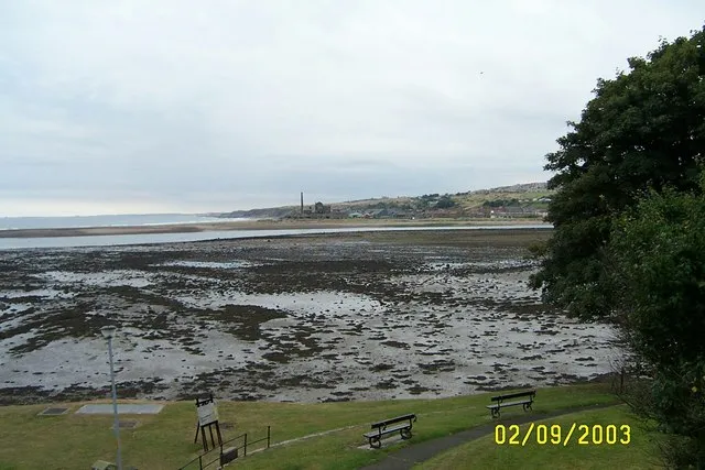
Photo: mike hancock, CC BY-SA 2.0, via Wikimedia Commons
There's a moment that happens to almost every American visitor to New Caledonia's south. You wake up, coffee in hand, ready to knock out your carefully color-coded itinerary — and a local gently tells you the pool you came for is underwater. Or worse, a mile of exposed mudflat.
That's the moment you learn the first rule of the Southern Lagoon: the tide chart is the real itinerary. Everything else — your restaurant bookings, your ferry times, your grand plans — bends around it.
The good news? Once you get the hang of it, planning around the tide isn't a hassle. It's the single best travel hack in the South Pacific.
Why the Tide Runs the Show Here
New Caledonia is surrounded by the world's largest enclosed lagoon, and its southern reaches — from the shallow flats near Nouméa out to the Isle of Pines — are extraordinarily tide-sensitive. We're talking gentle gradients, wide sand flats, and reef passages that open and close like valves. A three-foot swing in water level can transform a snorkeling spot from a glittering aquarium into a knee-deep puddle, or reveal a walkable sandbar that vanishes within the hour.
Back in the States, you might plan a beach day around parking and weather. Here, you plan it around a printed tide table — available free at the tourism office in Nouméa, posted at most guesthouses, or easy to pull up on sites like mareespeche.com. The times listed are for Nouméa; add roughly 20–30 minutes for the Isle of Pines.
Timing the Classics
Piscine Naturelle, the Isle of Pines
The famous natural pool at Piscine Naturelle is swimmable at most tides, but it's magical at mid-to-high tide, when the water depth is at its best and the coral bommies sit just below the surface. Aim to arrive within two hours of high tide. Go at dead low and you'll be picking your way over coral in a foot of water — doable, but hard on the reef and your shins.
Low tide isn't wasted, though. It's when the beach in front of the Meridien opens up into that postcard-wide stretch of white sand and strangled pines. Photographers, take note: low tide plus late afternoon light is the shot.
Sandbar Walks and Shell Flats
The southern lagoon's flats are where low tide becomes the main attraction. Around Baie de la Moselle in Nouméa and the shallows along the southern coast, dropping water exposes sandbanks you can walk for hundreds of yards, often with rays, hermit crabs, and wading birds all around you. Time a walk for an hour or two before low tide, and give yourself a hard rule: turn back when the water starts returning. The lagoon doesn't negotiate.
Snorkeling the Reef Passages
Want to snorkel through a reef pass? Slack high tide is your window. Water flowing into the lagoon brings clear ocean water with it, and the current is at its laziest. Mid-tide on a falling sea, the same pass can turn into a treadmill. If you're booking a snorkel tour, ask the operator when they're running — good ones always schedule around the tide, which tells you everything you need to know.
A Simple Daily Rhythm
Here's how a tide-literate day in the south tends to look:
- Falling tide, morning: Walk the flats, beachcomb, photograph the exposed sandbars.
- Slack low: Beach time on the big empty stretches; lunch.
- Rising tide, afternoon: Swim and snorkel as water depth and clarity build.
- Slack high: Reef passes, deeper lagoon swims, sunset paddling.
You'll quickly notice the pattern flips every 12 hours or so, and shifts about 50 minutes later each day. If high tide falls at 10 a.m. today, your flats walk is a morning activity tomorrow. After two days of checking the chart, reading it becomes automatic — like checking the weather back home.
One Caveat: Ask Before You Wander
A falling tide on a wide flat is a gift, but lagoons have their quirks. Channels between islets can carry surprising current, and some traditional fishing areas have customary access rules. When in doubt, ask at your guesthouse or a local dive shop. Kanak communities along the southern coast are generally warm and happy to point you toward the right flat at the right hour — and the greeting custom (saying hello before anything else) applies on the sandbars too.
The Payoff
Travelers who ignore the tide chart spend their trip fighting the water's schedule. Travelers who embrace it get a two-for-one destination: the same bay becomes a snorkeling spot at high tide and a moonscape of tidal pools at low, no extra ferry ticket required.
So grab that free tide table on day one, circle the highs and lows, and build your days around them. The lagoon already has a plan for you. All you have to do is read it.